


 There is still a lot of fun to be had as this snow day becomes a snow night on Capitol Hill. But we’re starting to look ahead at what comes next (don’t frown — more snow day photography, below). It will be a bit of a mess. Broadway, Madison and 23rd are the highest priority routes in the area so expect the City to put the most muscle into getting those streets clear. SDOT is posting a list of closed streets here. Capitol Hill and the nearby isn’t part of the roster. On the weather front, it’s going to stay cold and get a bit colder tonight but we’ve seen most of the snow we’re going to get, according to the National Weather Service. Thursday morning’s commute is going to be complicated but doable. SDOT says side streets are likely to remain minor disasters for the time being:
Seattle deployed a fleet of 30 plows, de-icing trucks, and graders to remove snow from approximately 750 miles of priority roadways in the city today. Residents are discouraged from traveling to help keep roads open and safe for emergency vehicles, transit and snow removal.
Road crews continue to focus on plowing and salting major arterials and transit routes for emergency vehicles and buses. If you must drive, be prepared with tire chains, warm clothes and sturdy footwear. Be aware of the potential for icy or slippery conditions.
On residential streets, residents should be cautious about accumulated ice and snow which will not clear until temperatures rise above freezing for an extended period.
Cliff Mass says Friday’s rain will wash away everything that hasn’t melted in the meantime. But let’s not get too far ahead. It should be windy and slippery for Denny Way sledders tonight — provided SDOT doesn’t decide to clear the road. Have fun. Stay safe. Stay warm. Pictures and more snow day/snow night updates below.
Check out our Wednesday morning #seasnow post for links to tools and travel planning sites. You can tell us what you’re seeing via Facebook, Twitter, or email — or call/txt (206) 399-5959.
And now, back to snow day/snow night.
- This isn’t even on Capitol Hill — it happened in the Central District — and we already posted it earlier today. But we like it. So it goes here, too.
Jeep towing Seattle Metro bus up snowy MLK Ave from Phil McGilton on Vimeo.
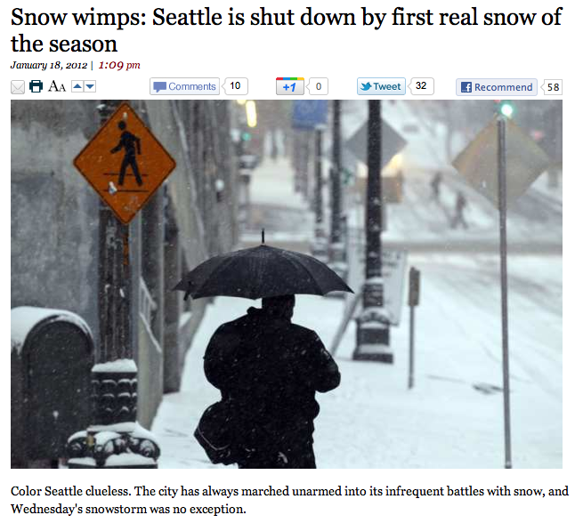
- Los Angeles Times calls us wimps:
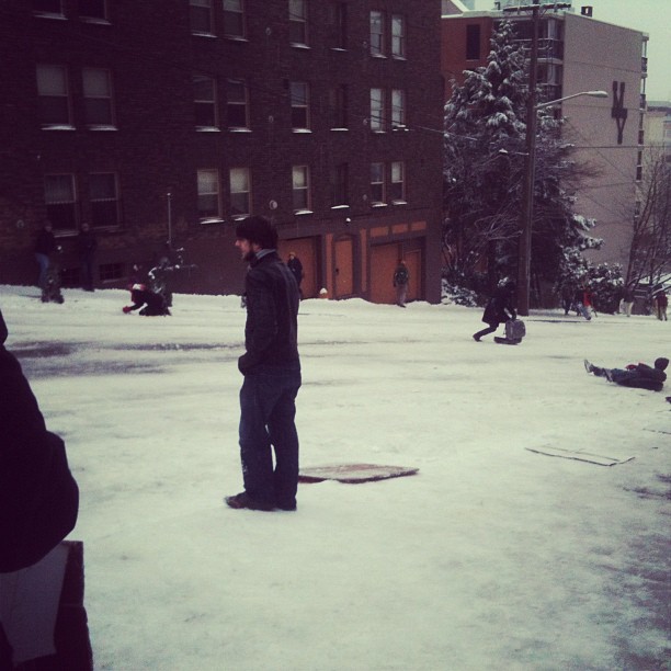
- Denny Way is already filling up with sledding hipster goodness:
 (Image: @lizfaw)
 (Image: @winefolly)
- As the kids say, holy shit I’d never do that:
 (Image: @brianbrian)
- The highest point on Capitol Hill, Volunteer Park at 453 feet above sea level is #5 on Seattle’s highest elevations.
- Best place to sled (safely) are these CHS Volunteer Park Sled Runs
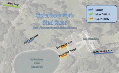
- This King County Capitol Hill Elevation map shows the range of elevations across the Hill from 200 ft down in I5 Shores to 300 ft on Broadway and 400 ft above 12th.
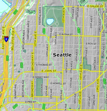
- Here’s the city’s map of the steepest streets in Seattle.
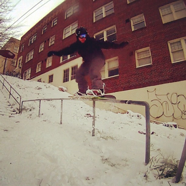
Hand rails! http://instagr.am/p/iYgM6/
Whoa. Added above!
Hey all! I shot a ton of sledding photos today over on E. Denny Way @ Bellevue Ave and thought I’d share them here too – enjoy!
https://picasaweb.google.com/114717044233195408762/SnowDayOn
These are great! Adding above!
Thanks for adding to this page too, CHSBlog rocks! I think this shot one is one of my favorites: https://plus.google.com/photos/114717044233195408762/albums/
Guy on tiny horse w/monkey hat + guy in laundry basket w/monkey hat + little dude launching into his ride down the hill captured while still suspended off the ground!
I put this together this evening. It’s from footage throughout the afternoon in Capitol Hill – http://youtu.be/pbVMtaBcpAs
might i suggest a posting a collection of photos of the various snow-characters that have been extra creative this year? (examples – slayerman and peeman!: http://www.flickr.com/photos/m33gs/6722567255/)
I went to the City’s page and took a look at the list, and i noticed that two of these streets don’t exist!
Here’s the list (steepest blocks in Seattle) directly from the City’s webpage:
26.04% E Roy St (25th Ave N to 26th Ave N)
23.8% E Boston St (Harvard Ave to Broadway Ave)
23.6% E Highland Dr (24th Ave N to 25th Ave N)
22.6% Mercer St (Melrose Ave to Eastlake Ave)
22.5% E Boston St (Boylston Ave to Harvard Ave)
22.4% Mercer St (24th Ave N to 25th Ave N)
22.3% E Prospect St (24th Ave N to 25th Ave N)
22.0% Helen St (24th Ave N to 25th Ave N)
21.7% Helen St (25th Ave N to 26th Ave N)
21.5% Ward St (25th Ave N to 26th Ave N)
These two:
22.6% Mercer St (Melrose Ave to Eastlake Ave)
22.5% E Boston St (Boylston Ave to Harvard Ave)
were removed in about 1961 when the construction of Interstate 5 plowed a huge trench through the heart of the city.
Also the City’s list uses directionals on the street names that are from BEFORE the the directionals were re-organized in the 1960s. Those Avenues on the east slope of the hill should be Ave E not Ave N and the Avenues on the west slope should also be Ave E.
The page states the survey report is from 1969, but that is seems unlikely.